Somerset · TA21
Drone mapping services in Wellington
A Blackdown Hills town with a large allocation on its northern side and a station being brought back, so corridor and platform work run side by side.
A small town taking a large amount of new housing
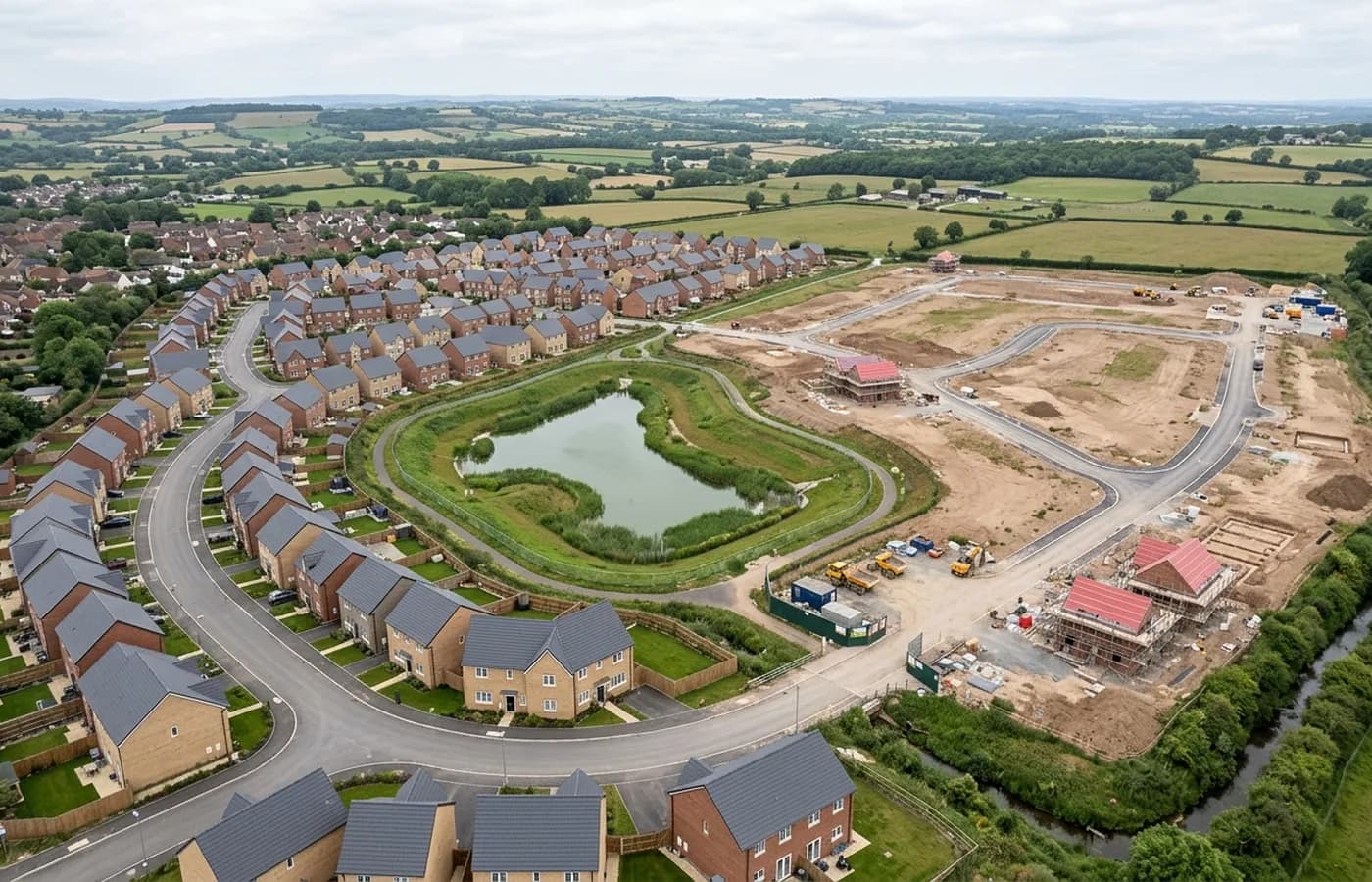
Wellington has taken substantial new housing on its northern and eastern edges relative to its size, and land there continues to come forward. On sites of that proportion the interesting survey question is the interface: how new ground ties into the existing town, where the levels meet, what happens at the boundary between an estate platform and an old lane.
Interfaces are exactly where a scaled aerial image beats a set of separate topographic strips, because everything is in one coordinate system and the joins are visible rather than inferred.
Rail returning to the town
Bringing a station back to a town that lost one puts a live railway corridor at the centre of local planning work. Anything near an operational line is arranged with whoever controls it before a date is set, and the flying itself is corridor pattern rather than block: strips along the alignment with the extra overlap that strip processing needs.
For a client, the practical consequence is lead time. Rail-adjacent work is not a next-day job, and building a week into the programme avoids a wasted trip.
Between the motorway and the hills
The town sits on the lower ground with the Blackdown Hills rising to the south and the M5 running past to the north, which gives a real spread of relief across a small area. A site on the hill side of town carries height change a site by the motorway does not, and the flight plan follows that rather than a single fixed height.
Hill cloud is an occasional factor on the higher ground, less often than on Dartmoor but often enough that a marginal day is checked before setting off rather than after arriving.
Practical points
Wellington is around an hour from base, and it sits close enough to Taunton that a client with sites in both can have them flown on the same trip.
The town's older centre is compact and low rise, so urban work here is easier than in most places on this list, and the harder jobs are the large edge platforms where wind across open ground is the limiting factor.
The mill complex, and buildings too big to photograph
The town's woollen legacy leaves it with a very large mill complex, the sort of site where a survey on foot takes days and still misses the roofs. Big industrial estates of that kind are among the most rewarding things to fly: extensive roofscapes at several levels, courtyards, connecting structures and a footprint nobody has ever recorded accurately.
For a site like that the useful package is a plan capture of every roof plus oblique passes around the whole envelope, which together give a client something they can plan phasing from.
Above the town the escarpment and its monument mean sites on the higher ground catch wind that the valley floor does not, so two sites a mile apart here can have quite different flying conditions on the same morning.
The town centre itself is compact, low rise and quiet, which makes it one of the more straightforward places on this list to fly an urban plot. Where a site sits between the mills and the centre, the two conditions meet in one boundary, and the flight plan reflects that rather than treating the whole site the same way.
Behind the survey
What is behind a Wellington mapping flight
CAA registered operator
Operator ID and Flyer ID held, which is the baseline anyone commissioning a flight over a live site should be asking to see before anything takes off.
A2 Certificate of Competency
The qualification that covers flying closer to people and property than the open default allows, which is what a built up site or a town centre survey needs.
100 megapixel Hasselblad camera
On a DJI Mavic 4 Pro. Resolution is the whole argument on a mapping job: it decides whether a stitched site map shows a plot peg or a smudge.
Radiometric thermal camera
A DJI Mavic 2 Enterprise Advanced with a 640 by 512 thermal sensor, for the jobs where a site needs a heat reading alongside the map.
Insured with Coverdrone
Full commercial cover. Certificates go to your site team or your client before the visit if that is part of your process.
Written note within 48 hours
Every job comes with a written record of conditions, coverage and the limits of the data, not just a folder of files with no explanation attached.
Construction background
The surveyor came into this from building work rather than from photography, so a site brief about levels, access and programme lands without translation.
Nearby
Also covered around Wellington
- TauntonSomerset's county town, with garden community scale growth on two edges, a regenerating centre, and flat Tone valley ground that floods and models well.
- CullomptonMotorway-corridor town with a garden village allocation beside it, flat Culm valley ground, and earthworks big enough to make volumes worth measuring.
- TivertonMid Devon's largest town, with a long-running eastern urban extension, a parkway station on the main line and steep Exe valley ground on its western side.
See the output formats
Request a mapping quote in Wellington
Send the boundary and what the data is for. Sam Hembury will come back with a fixed price for the site and the next slot the weather suits.