Devon · TQ12
Drone mapping services in Newton Abbot
A market and racing town on the Teign estuary with a large western extension, a link road and low marsh ground that decides how a flight is timed.
The western edge is where the work is
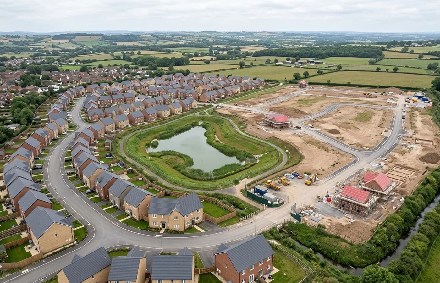
Newton Abbot's growth has concentrated on the western side of the town, at a scale that involves new roads and drainage as much as housing. Sites like these change shape quickly during the early works, when the ground is being stripped, hauled and regraded, and a survey taken in March describes a site that no longer exists in June.
That is an argument for repeat capture rather than a single map, and the towns where the argument holds best are the ones with a big platform being moved in stages. This is one of them.
Marsh, estuary and a floodplain in the middle of town
The town sits at the head of the Teign estuary on low ground, with marshland and the racecourse floodplain forming a wide flat area right through the middle of it. Low, wet ground and tidal edges have the same two implications everywhere they appear in this coverage area: the terrain model carries more weight because small height differences matter, and standing water leaves gaps.
Anything that touches the estuary itself gets flown against the tide table. Anything on the marsh gets flown after a dry spell if the levels actually matter, because sheet water on grazing marsh is invisible to the process and awkward to explain away later.
A link road, a racecourse and an old industrial edge
Between the road improvements, the racecourse and the older industrial ground near the river and the railway, this town carries a wider mixture of survey subjects than most places its size. Corridor work along a road alignment, block mapping over a development platform, and existing conditions models over industrial buildings are three different flights.
Where a client has more than one of those in the same programme, it is usually cheaper to combine them into one visit and process them separately than to book three days.
Practical points for flying here
The town is twenty minutes from base down the A380, so it is comfortably inside a single visit and inside the fixed price.
The one local constraint worth flagging is how built up the middle is: the older core is dense, the railway runs through it, and a site in there usually has uninvolved people and neighbouring property close on more than one side. That is normal urban flying, and it is what the A2 qualification covers, but it changes where the operator stands.
Clay workings to the north west
The Bovey basin north west of the town has been worked for ball clay for a very long time, and the extraction landscape there is a natural subject for repeat capture: working faces, settling ponds, stockpiles and restored ground, all of it changing measurably between visits.
Extraction sites also make the strongest case for consistent processing. A volume that is compared between two dates is only as good as the sameness of the two surveys, which is why a monitoring programme is set up as a programme at the first flight rather than assembled from unrelated visits later.
Behind the survey
What is behind a Newton Abbot mapping flight
CAA registered operator
Operator ID and Flyer ID held, which is the baseline anyone commissioning a flight over a live site should be asking to see before anything takes off.
A2 Certificate of Competency
The qualification that covers flying closer to people and property than the open default allows, which is what a built up site or a town centre survey needs.
100 megapixel Hasselblad camera
On a DJI Mavic 4 Pro. Resolution is the whole argument on a mapping job: it decides whether a stitched site map shows a plot peg or a smudge.
Radiometric thermal camera
A DJI Mavic 2 Enterprise Advanced with a 640 by 512 thermal sensor, for the jobs where a site needs a heat reading alongside the map.
Insured with Coverdrone
Full commercial cover. Certificates go to your site team or your client before the visit if that is part of your process.
Written note within 48 hours
Every job comes with a written record of conditions, coverage and the limits of the data, not just a folder of files with no explanation attached.
Construction background
The surveyor came into this from building work rather than from photography, so a site brief about levels, access and programme lands without translation.
Nearby
Also covered around Newton Abbot
- TorquayA steep resort town where the work is hotel and hillside plots, edge-of-town employment land, and recording buildings stacked up a limestone slope.
- TotnesA steep town on the tidal Dart with a long-running brownfield regeneration at its centre, where the questions are levels, structures and river access.
- ExeterThe busiest source of mapping work in the region, with land coming forward on every edge of the city and an airport control zone over its eastern side.
- DawlishThe town where the main line runs along the sea wall, which makes coastal and rail infrastructure the dominant survey subject rather than housing land.
See the output formats
Request a mapping quote in Newton Abbot
Send the boundary and what the data is for. Sam Hembury will come back with a fixed price for the site and the next slot the weather suits.