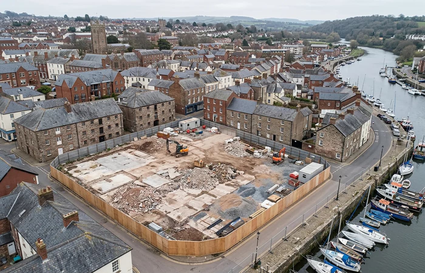
Devon · TQ1-TQ2
Drone mapping services in Torquay
A steep resort town where the work is hotel and hillside plots, edge-of-town employment land, and recording buildings stacked up a limestone slope.
Sites stacked on a hillside
Torquay is built across a series of steep hills above its harbour, and that geometry is the defining feature of survey work here. A plot with ten or fifteen metres of fall across it is normal, and buildings sit at heights relative to each other that a plan view does not communicate at all.
For anything on that kind of ground, the useful deliverable is usually a model rather than a map. Sections through a site, existing levels at the boundary, and the relationship between a proposed building and the ones stepping down the hill either side of it are the questions that come up in planning, and they are three dimensional questions.
Hotel stock, conversions and change of use
A large share of the design work in this town involves existing buildings changing use: substantial Victorian and Edwardian hotel and villa stock being converted, extended or replaced. That is existing conditions capture, which means oblique flying around a structure at several heights rather than a grid over the top of it.
It also means flying in tight urban settings with neighbours close on every side, which is what the A2 Certificate of Competency covers and why it is worth checking an operator holds one before booking work in a town centre.
The employment land is easier ground
Out towards the ring road and the northern edge the ground flattens and the sites are larger and simpler: employment land, commercial plots and highway margins that fly like anywhere else. Those are straightforward block surveys with contours.
The contrast between the two halves of this town's work is bigger than in most places, and it is worth being specific in the brief about which one a job is, because the flight, the time on site and the outputs are all different.
Season, crowds and access
In summer, the harbour, seafront and central streets are busy in a way that shapes where an operator can fly and stand. Early starts and out of season dates are the practical answers for anything near the front.
Torquay is around forty minutes from base, and the awkward part of a job here is rarely the distance. It is finding somewhere legal, safe and sensible to launch on a hillside street with parked cars on both sides, which is a site visit question rather than a processing one.
Retaining walls and terraced plots
A town built on limestone hills is a town full of retaining structures, and a great many plots here sit on made ground held up by a wall somebody built a century ago. Recording those is a common commission on its own: a wall face, its height, its condition and its relationship to what sits above and below it.
A wall face is a vertical surface, so it needs angled capture from a standoff distance rather than a plan grid, and it usually needs several passes at different heights to build a usable model. That is worth an extra twenty minutes in the air and it is the difference between a picture of a wall and something an engineer can work from.
Behind the survey
What is behind a Torquay mapping flight
CAA registered operator
Operator ID and Flyer ID held, which is the baseline anyone commissioning a flight over a live site should be asking to see before anything takes off.
A2 Certificate of Competency
The qualification that covers flying closer to people and property than the open default allows, which is what a built up site or a town centre survey needs.
100 megapixel Hasselblad camera
On a DJI Mavic 4 Pro. Resolution is the whole argument on a mapping job: it decides whether a stitched site map shows a plot peg or a smudge.
Radiometric thermal camera
A DJI Mavic 2 Enterprise Advanced with a 640 by 512 thermal sensor, for the jobs where a site needs a heat reading alongside the map.
Insured with Coverdrone
Full commercial cover. Certificates go to your site team or your client before the visit if that is part of your process.
Written note within 48 hours
Every job comes with a written record of conditions, coverage and the limits of the data, not just a folder of files with no explanation attached.
Construction background
The surveyor came into this from building work rather than from photography, so a site brief about levels, access and programme lands without translation.
Nearby
Also covered around Torquay
- PaigntonThe flatter half of Torbay, with large edge-of-town housing land, a level seafront and open ground that gives some of the cleanest terrain models here.
- Newton AbbotA market and racing town on the Teign estuary with a large western extension, a link road and low marsh ground that decides how a flight is timed.
See the output formats
Request a mapping quote in Torquay
Send the boundary and what the data is for. Sam Hembury will come back with a fixed price for the site and the next slot the weather suits.