Devon · TQ3-TQ4
Drone mapping services in Paignton
The flatter half of Torbay, with large edge-of-town housing land, a level seafront and open ground that gives some of the cleanest terrain models here.
Where the bay does its housing growth
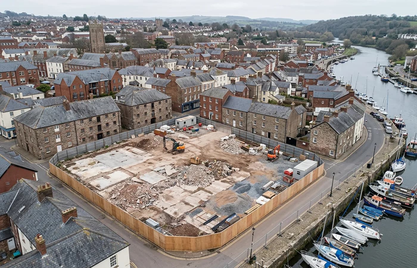
Between the three Torbay towns, Paignton carries the largest share of the greenfield housing land, out on the western edge where the built up area meets farmland. Sites there are large, open and reasonably flat, which is close to ideal for mapping.
The typical commission is a block survey with contours and a volume: what is there now, what the levels do, how much material has to move to get a platform. On open ground with modest hedge density, that is a clean result and a short flight.
A level front, and what that means for capture
The seafront here is flat and wide, a green and a long promenade rather than a wall against a cliff, and that makes it more straightforward to survey than the coast a few miles north. Public realm schemes, car parks, event space and drainage all sit on ground the camera can see properly from above.
The constraint is people. A wide open public space in summer is full of them, and a survey there is either early, out of season, or run with a managed perimeter. None of that is difficult, but it decides the date.
The harbour and the older core
Around the harbour and the older streets behind it, the pattern changes to dense frontages, small plots and mixed building ages. That is oblique work, and the useful output is usually an elevation traced from a model rather than a plan.
There is also a steady flow of smaller commissions here that never reach a design office: an owner wanting a record of a building before work starts, an agent wanting an accurate site extent for a sale, a management company wanting to know what is actually on a flat roof. All of them are the same flight at a smaller scale.
Getting a job flown
Base to Paignton is about forty five minutes. Because sites here are typically larger and more open than in Torquay, a job is more often a single straightforward visit and the price reflects the area rather than the difficulty.
Where a client has plots in both towns, flying them on the same day is usually sensible, and processing them separately keeps each set of files clean.
Holiday parks and large managed sites
The flat ground behind the beach and out towards Goodrington carries holiday parks, caravan sites and large managed leisure grounds, and those have survey needs that most people do not think about. Pitch layouts, hardstanding extents, drainage runs, road widths and the actual area of a site as opposed to the area in the deeds.
All of it comes off one orthomosaic with contours under it, and for a site that is being reorganised or extended, having the existing layout accurately in CAD saves a great deal of guessing later. These are also easy sites to fly: open, low rise, and quiet outside the season.
Between the seafront, the zoo grounds and the western edge, the town also carries several large single-owner sites where one organisation controls the whole boundary. Those are the easiest jobs on this list to arrange, because access, timing and the perimeter are all one conversation with one person rather than five.
Behind the survey
What is behind a Paignton mapping flight
CAA registered operator
Operator ID and Flyer ID held, which is the baseline anyone commissioning a flight over a live site should be asking to see before anything takes off.
A2 Certificate of Competency
The qualification that covers flying closer to people and property than the open default allows, which is what a built up site or a town centre survey needs.
100 megapixel Hasselblad camera
On a DJI Mavic 4 Pro. Resolution is the whole argument on a mapping job: it decides whether a stitched site map shows a plot peg or a smudge.
Radiometric thermal camera
A DJI Mavic 2 Enterprise Advanced with a 640 by 512 thermal sensor, for the jobs where a site needs a heat reading alongside the map.
Insured with Coverdrone
Full commercial cover. Certificates go to your site team or your client before the visit if that is part of your process.
Written note within 48 hours
Every job comes with a written record of conditions, coverage and the limits of the data, not just a folder of files with no explanation attached.
Construction background
The surveyor came into this from building work rather than from photography, so a site brief about levels, access and programme lands without translation.
Nearby
Also covered around Paignton
- TorquayA steep resort town where the work is hotel and hillside plots, edge-of-town employment land, and recording buildings stacked up a limestone slope.
- TotnesA steep town on the tidal Dart with a long-running brownfield regeneration at its centre, where the questions are levels, structures and river access.
- Newton AbbotA market and racing town on the Teign estuary with a large western extension, a link road and low marsh ground that decides how a flight is timed.
See the output formats
Request a mapping quote in Paignton
Send the boundary and what the data is for. Sam Hembury will come back with a fixed price for the site and the next slot the weather suits.