Devon · EX17
Drone mapping services in Crediton
A market town among large Mid Devon landholdings, where the mapping work is as often a farm, an estate or a drainage catchment as it is a building plot.
Estate and farmland work, not just development sites
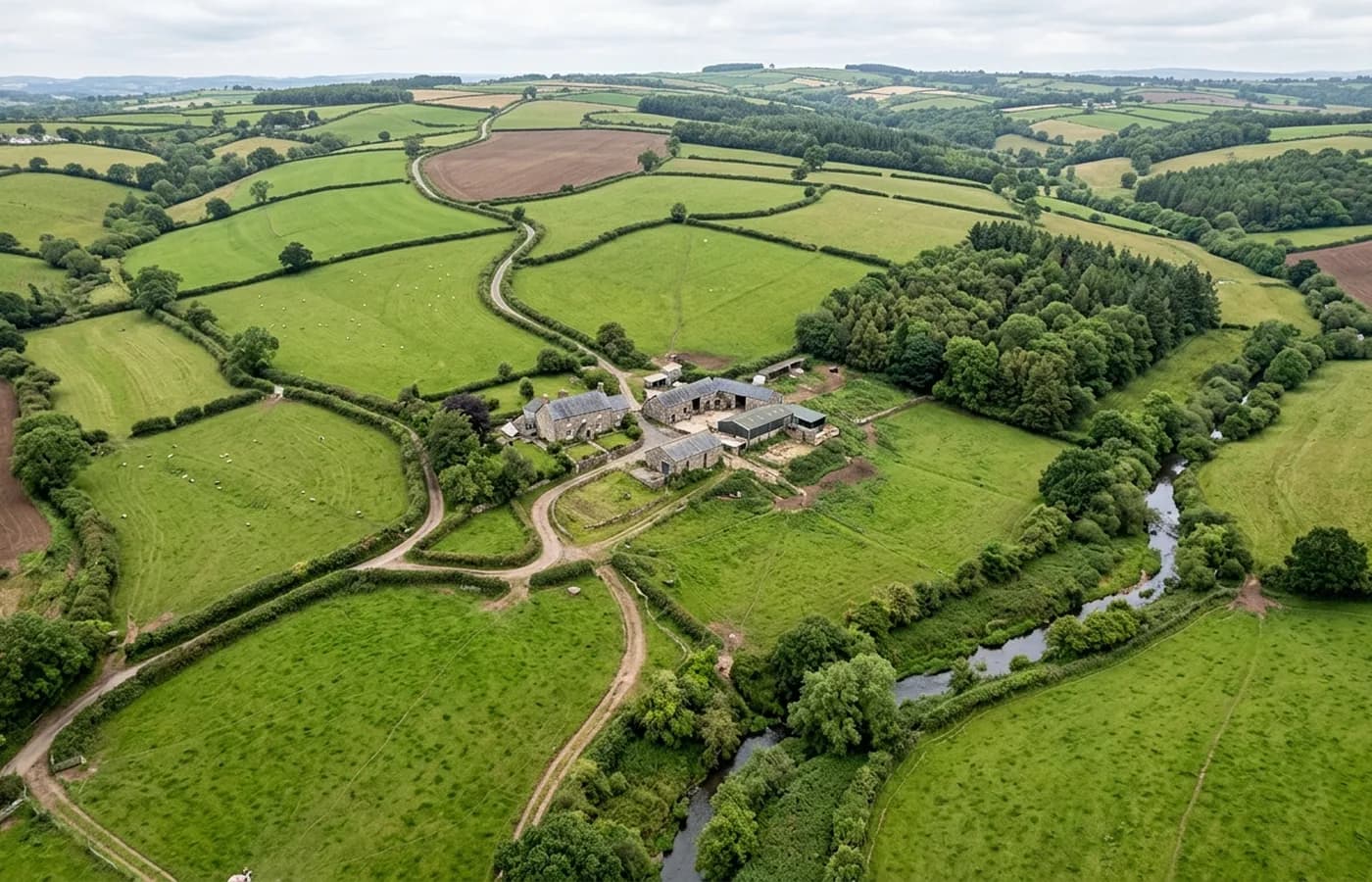
Around Crediton the commissions look different from the ones in the growth towns. Farms and estates need field boundaries mapped for entitlement and stewardship paperwork, drainage runs traced across a catchment, tracks and access recorded, buildings measured before conversion. A large landholding often has no accurate plan of itself at all beyond a title map drawn from an older survey.
An orthomosaic of a whole holding, flown in one visit, answers a surprising number of those at once. Boundaries, hardstanding, roof areas for a grant application, the actual line of a watercourse rather than the line somebody drew in 1965.
Red soil, steep fields and the shape of the Yeo valley
This is the Devon red land, and the ground rolls hard: fields that look gentle from a gateway have a good deal of fall across them, and hedge banks divide the landscape into small units at close spacing. Both matter for mapping. Heavy hedge networks mean a larger share of the surveyed area is object rather than ground, and the terrain under them is inferred.
The upside is that the field pattern is legible from above in a way it is not from the ground, which is exactly why an aerial record settles boundary and area questions faster than a walk round with a measuring wheel.
Barn conversions and agricultural buildings
A steady share of the design work around here is conversion of agricultural buildings, and that is model work rather than map work. What an architect needs is the existing structure in three dimensions: elevations, roof form, the relationship between a barn and the yard around it, levels at the threshold.
Stone and cob barns are good subjects for photogrammetry because they are textured and matt. Corrugated sheet and modern portal frames are harder, because a large plain reflective roof gives the process very little to match on, and that is worth knowing before commissioning a model of a modern shed.
Access, and why rural jobs need a phone call first
Rural sites are easy to fly and awkward to reach. Gateways, livestock, stock movements and shared tracks all decide where an operator can actually stand, and a five minute call with whoever farms the ground saves an hour on the day.
Crediton is twenty minutes from base, so a rural block here is straightforwardly a single visit, and a second flight later in the season to catch a different crop or vegetation state is not an expensive proposition.
Weather windows in the Creedy valley
This valley is open to Atlantic weather from the west with very little shelter, and it holds damp air once the rain has passed. In practice that means fewer settled mapping windows through the winter than the east of the county gets, and a greater gap between a dry forecast and dry ground.
For farm and estate work, that is less of a problem than it sounds, because the useful flying season for field boundary and drainage work is when the ground is bare or the crop is short. Agreeing a target fortnight rather than a fixed morning usually gets a better dataset than pushing a date that the weather was never going to honour.
Behind the survey
What is behind a Crediton mapping flight
CAA registered operator
Operator ID and Flyer ID held, which is the baseline anyone commissioning a flight over a live site should be asking to see before anything takes off.
A2 Certificate of Competency
The qualification that covers flying closer to people and property than the open default allows, which is what a built up site or a town centre survey needs.
100 megapixel Hasselblad camera
On a DJI Mavic 4 Pro. Resolution is the whole argument on a mapping job: it decides whether a stitched site map shows a plot peg or a smudge.
Radiometric thermal camera
A DJI Mavic 2 Enterprise Advanced with a 640 by 512 thermal sensor, for the jobs where a site needs a heat reading alongside the map.
Insured with Coverdrone
Full commercial cover. Certificates go to your site team or your client before the visit if that is part of your process.
Written note within 48 hours
Every job comes with a written record of conditions, coverage and the limits of the data, not just a folder of files with no explanation attached.
Construction background
The surveyor came into this from building work rather than from photography, so a site brief about levels, access and programme lands without translation.
Nearby
Also covered around Crediton
- ExeterThe busiest source of mapping work in the region, with land coming forward on every edge of the city and an airport control zone over its eastern side.
- TivertonMid Devon's largest town, with a long-running eastern urban extension, a parkway station on the main line and steep Exe valley ground on its western side.
- OkehamptonA moor-edge town with a reopened railway, quarrying history and military danger areas above it, where airspace and terrain are both harder than average.
- BarnstapleNorth Devon's main town, with riverside regeneration, a large western growth area, and the Chivenor airfield sitting a few miles down the estuary.
See the output formats
Request a mapping quote in Crediton
Send the boundary and what the data is for. Sam Hembury will come back with a fixed price for the site and the next slot the weather suits.