Devon · EX15
Drone mapping services in Cullompton
Motorway-corridor town with a garden village allocation beside it, flat Culm valley ground, and earthworks big enough to make volumes worth measuring.
Growth planned at a different scale to the town
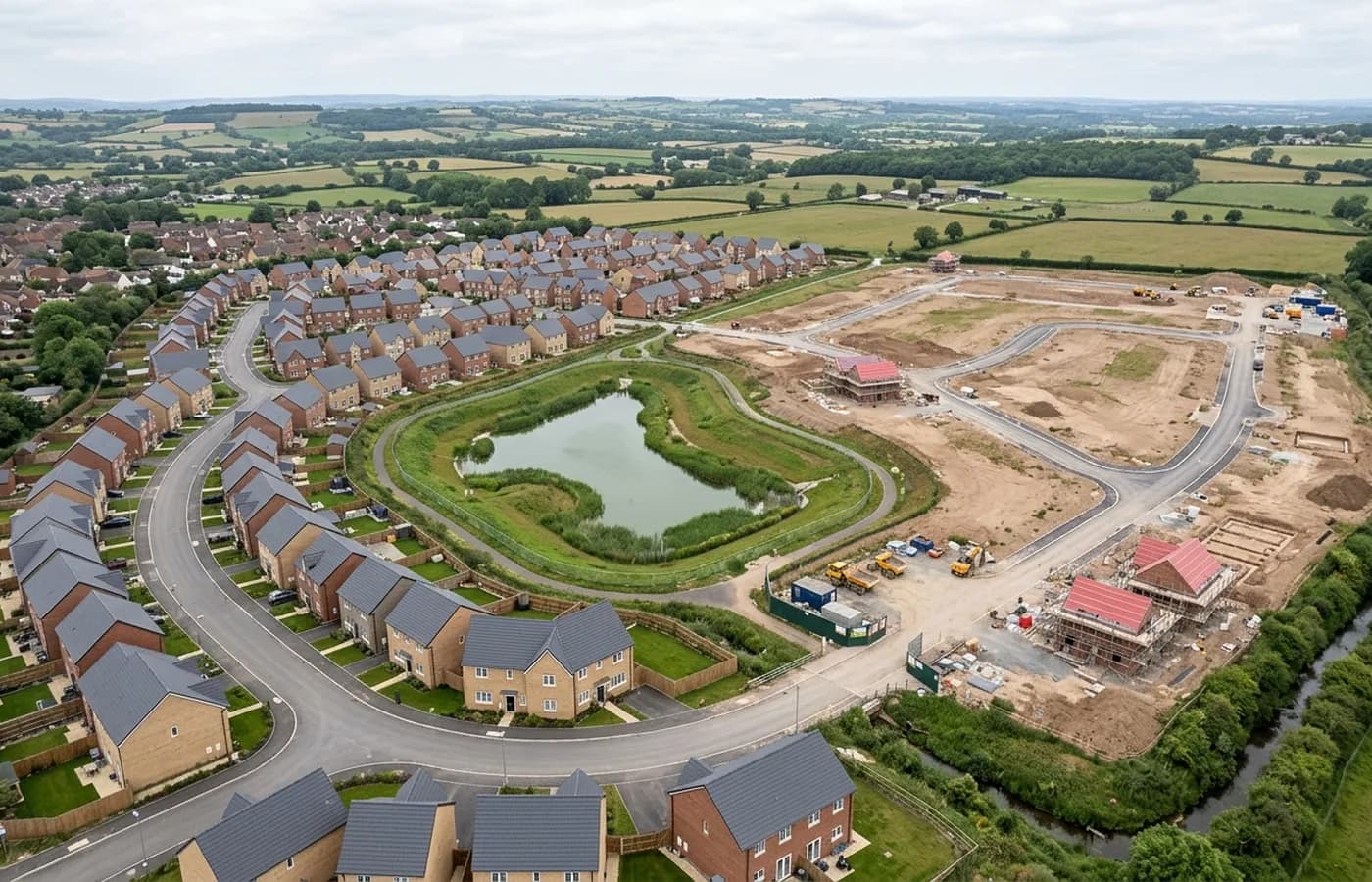
Cullompton is one of the few places in Mid Devon where the land coming forward is larger than the existing town, and that changes what a survey is for. On a site of that size nobody is mapping a plot, they are mapping a landscape: field systems, watercourses, existing tracks, hedge networks and the levels across a couple of miles of farmland.
Work at that scale is flown in blocks and stitched, and it is worth agreeing at the outset which parts are needed at full resolution and which only need enough detail to show extent. Flying an entire allocation at the resolution a single plot would get is possible and rarely the best use of the budget.
The motorway junction is the whole context
Everything here relates to junction 28 of the M5 and the road network hanging off it. Highway and access work generates its own survey needs, and they are different from housing ones: long thin corridors rather than blocks, more attention to the existing carriageway and verge, and levels that have to be consistent along a route rather than accurate in a single field.
Corridor flying is a distinct pattern. It is planned as a strip with the aircraft working along the alignment, and it usually needs more overlap than a block survey to hold the strip together through processing.
Flat valley floor, and what that gives the data
The Culm valley floor is properly flat by Devon standards, which makes for clean, even photogrammetry: consistent ground distance across the frame, no deep shadow pockets, no steep faces the camera has to work around.
The trade is drainage. Flat ground holds water and frost, and this valley does both. On a wet week the low fields carry sheet water that leaves gaps where the terrain model is most wanted, so a site being surveyed for drainage design is worth timing rather than rushing.
A town core that has not moved in centuries
Behind the growth is a medieval and Georgian core along Fore Street with cob and thatch in the older lanes. Thatch, cob and timber frame do not behave like brick in a model: soft edges, no crisp lines to match against, and roof surfaces that scatter light rather than reflecting it evenly.
Where a job in the old town needs measured detail, oblique capture at a close standoff does more for it than a higher grid. That is a flight planning decision made before the day, not a processing fix afterwards.
Heritage buildings in the middle of a growth town
For all the land coming forward on its edges, Cullompton keeps an important set of historic buildings in the middle: a major parish church and a substantial Jacobean merchant's house among them. Recording buildings of that age and quality is oblique work at close standoff, flown carefully, and it is a different service to a site map even when both happen on the same visit.
The practical value of doing it from the air is that it reaches the parts nobody photographs: parapet gutters, valley roofs, the backs of elevations hemmed in by later building, and the junctions where an old roof meets a modern extension.
Behind the survey
What is behind a Cullompton mapping flight
CAA registered operator
Operator ID and Flyer ID held, which is the baseline anyone commissioning a flight over a live site should be asking to see before anything takes off.
A2 Certificate of Competency
The qualification that covers flying closer to people and property than the open default allows, which is what a built up site or a town centre survey needs.
100 megapixel Hasselblad camera
On a DJI Mavic 4 Pro. Resolution is the whole argument on a mapping job: it decides whether a stitched site map shows a plot peg or a smudge.
Radiometric thermal camera
A DJI Mavic 2 Enterprise Advanced with a 640 by 512 thermal sensor, for the jobs where a site needs a heat reading alongside the map.
Insured with Coverdrone
Full commercial cover. Certificates go to your site team or your client before the visit if that is part of your process.
Written note within 48 hours
Every job comes with a written record of conditions, coverage and the limits of the data, not just a folder of files with no explanation attached.
Construction background
The surveyor came into this from building work rather than from photography, so a site brief about levels, access and programme lands without translation.
Nearby
Also covered around Cullompton
- TivertonMid Devon's largest town, with a long-running eastern urban extension, a parkway station on the main line and steep Exe valley ground on its western side.
- ExeterThe busiest source of mapping work in the region, with land coming forward on every edge of the city and an airport control zone over its eastern side.
- HonitonA long high street town on the A30 with allocations on its eastern edge and an aerodrome on the ridge above, which puts airspace top of the checklist.
- WellingtonA Blackdown Hills town with a large allocation on its northern side and a station being brought back, so corridor and platform work run side by side.
See the output formats
Request a mapping quote in Cullompton
Send the boundary and what the data is for. Sam Hembury will come back with a fixed price for the site and the next slot the weather suits.