Devon · EX7
Drone mapping services in Dawlish
The town where the main line runs along the sea wall, which makes coastal and rail infrastructure the dominant survey subject rather than housing land.
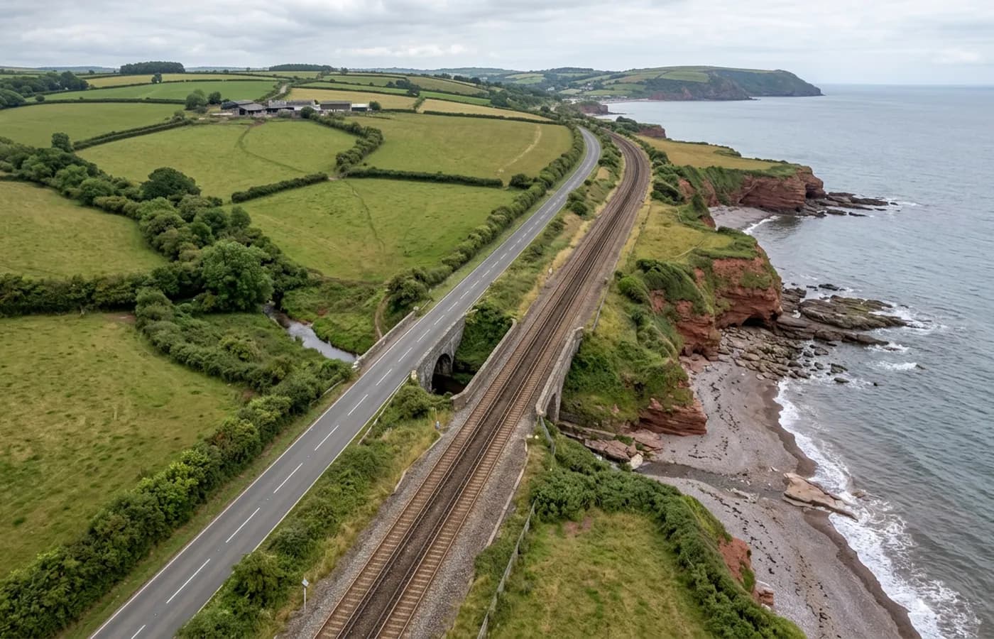
A railway on the edge of the sea
No stretch of railway in the country is better known for its exposure than the one running along the front here, and the engineering response to that has been a sustained programme of sea wall and cliff work. Infrastructure of that kind is a natural fit for aerial capture: long, thin, hard to get at from the ground, and changing measurably between visits.
A corridor along a sea wall is flown as a strip rather than a block, with heavier overlap to hold the strip together and oblique passes to record the face of the wall as well as the deck. Flying near an operational railway is arranged with whoever controls the line, and that arrangement comes before a date is agreed.
Cliffs, and why they need angled capture
The red sandstone cliffs either side of the town are actively weathering, and a cliff face is the clearest example there is of something a straight down grid cannot record. A vertical or overhanging face is invisible from directly above; it needs angled passes flown at a standoff distance, from several heights, to build a surface.
That is standard practice and it is worth stating at quoting stage, because a client expecting a cliff survey to be the same flight as a field survey is expecting the wrong thing. Cliff work takes longer in the air and produces a heavier point cloud at the end of it.
Tide, swell and the state of the sea
Everything at the waterline is timed to the tide, and on this coast the swell matters too. A low water flight gets the wall footing, the apron and the beach; a high water flight gets none of them. White water and spray across the frame also degrade matching, so a big sea is a reason to move a date rather than push on.
The note supplied with a coastal job records tide state and sea conditions at capture, for the same reason it records cloud cover: somebody comparing two dates later needs to know whether a change is erosion or just a different tide.
The town behind the front
Away from the sea wall, Dawlish is a Victorian and Edwardian resort town with a small stream running through the middle of it and steep ground rising quickly behind. Development sites here are mostly small and on the higher ground, and they fly easily compared with the coast.
Base is twenty five minutes up the coast road, so combining a coastal strip and an inland plot into one visit is realistic when both are ready.
The Warren, and ground that moves on its own
The sand spit at the mouth of the estuary is one of the more dynamic pieces of coast in Devon, and it changes shape without anyone doing anything to it. Where a client wants that measured, the method is the same as for cliffs: identical flights at intervals, processed identically, compared as surfaces rather than as pictures.
The cliff-top ground behind the town carries a large amount of bungalow and estate development that takes wind straight off the sea. Sites up there are simple to fly on a calm day and not worth attempting on a rough one, which is more a scheduling point than a technical one.
Behind the survey
What is behind a Dawlish mapping flight
CAA registered operator
Operator ID and Flyer ID held, which is the baseline anyone commissioning a flight over a live site should be asking to see before anything takes off.
A2 Certificate of Competency
The qualification that covers flying closer to people and property than the open default allows, which is what a built up site or a town centre survey needs.
100 megapixel Hasselblad camera
On a DJI Mavic 4 Pro. Resolution is the whole argument on a mapping job: it decides whether a stitched site map shows a plot peg or a smudge.
Radiometric thermal camera
A DJI Mavic 2 Enterprise Advanced with a 640 by 512 thermal sensor, for the jobs where a site needs a heat reading alongside the map.
Insured with Coverdrone
Full commercial cover. Certificates go to your site team or your client before the visit if that is part of your process.
Written note within 48 hours
Every job comes with a written record of conditions, coverage and the limits of the data, not just a folder of files with no explanation attached.
Construction background
The surveyor came into this from building work rather than from photography, so a site brief about levels, access and programme lands without translation.
Nearby
Also covered around Dawlish
- ExeterThe busiest source of mapping work in the region, with land coming forward on every edge of the city and an airport control zone over its eastern side.
- Newton AbbotA market and racing town on the Teign estuary with a large western extension, a link road and low marsh ground that decides how a flight is timed.
- ExmouthEstuary town with housing land coming forward inland and a reworked seafront, where salt air and tidal ground both shape when a survey can be flown.
See the output formats
Request a mapping quote in Dawlish
Send the boundary and what the data is for. Sam Hembury will come back with a fixed price for the site and the next slot the weather suits.