Devon · TQ9
Drone mapping services in Totnes
A steep town on the tidal Dart with a long-running brownfield regeneration at its centre, where the questions are levels, structures and river access.
Brownfield in the middle of a small town
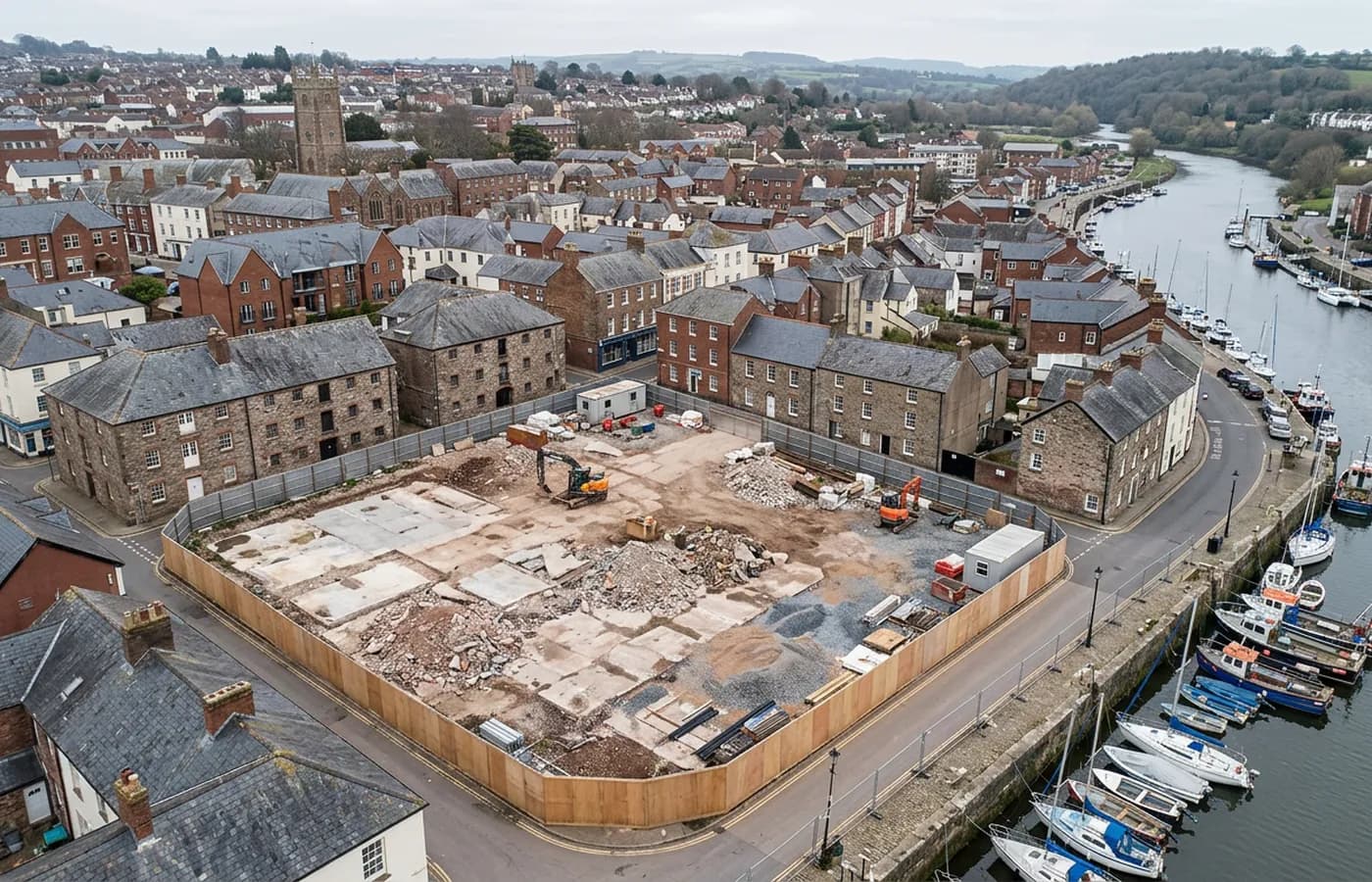
Totnes carries one of the better known brownfield regeneration sites in Devon, on former industrial ground near the station and the river, and brownfield of that kind is a different survey job to a greenfield allocation. There are existing structures, made ground, old surfaces at inconsistent levels, and a history of previous use that shapes everything drawn on top of it.
What a design team needs from a site like that is existing conditions in three dimensions: what stands, how tall it is, what the levels do across a yard, where the boundary walls actually run as opposed to where the deeds suggest.
A very steep high street and the ground it climbs
The town climbs hard from the river to the castle, and the older core is dense, narrow and stacked. Flying over it means working with a lot of height change in a small footprint, and it means the sensible launch points are limited and worth identifying before the day.
For a plot on the hill, the terrain model matters as much as the map. Access, ramp gradients and the level a threshold has to sit at are all decided by a few tenths of a metre, and they are what a client is actually buying when they commission height data on a site like this.
The Dart, and a tidal edge in the town
The river here is tidal up to the town, which puts a moving waterline through a number of sites. Quay walls, slipways and any structure with a footing below high water are recorded at low tide or not at all, and the tide table decides the appointment.
The riverside is also where a good deal of the town's future development sits, so this is not an occasional constraint. It is the normal condition of a Totnes job.
Conservation, and recording before intervention
A lot of the building stock here is old, protected and much altered. Recording a structure fully before it is changed costs very little at the time and is worth a great deal later, when somebody asks what was there beforehand.
The town is thirty five minutes from base down the A38, and a job usually combines a plan grid with a set of oblique passes, because almost nothing here is answered by a straight down view on its own.
Slate hanging, jetties and the estate country around it
The medieval core has slate-hung and jettied frontages that overhang the pavement, and an overhang is invisible from directly above. Anything projecting outward is recorded from an angle or not at all, which is the single most common reason a survey of an old town centre needs oblique passes rather than a grid.
Outside the town, the South Hams around Totnes carries substantial estates and parkland, and estate mapping is a steady part of the work in this area: field systems, tracks, woodland blocks, watercourses and the buildings scattered across a holding, flown as one dataset rather than as separate visits.
The town is also small enough that a client with several plots can have them all captured on one visit and processed separately, which is worth raising at the quoting stage. Flying is a small part of the cost on a job like that; the travel and the processing are the rest, and both scale better across a group of sites than they do one at a time.
Behind the survey
What is behind a Totnes mapping flight
CAA registered operator
Operator ID and Flyer ID held, which is the baseline anyone commissioning a flight over a live site should be asking to see before anything takes off.
A2 Certificate of Competency
The qualification that covers flying closer to people and property than the open default allows, which is what a built up site or a town centre survey needs.
100 megapixel Hasselblad camera
On a DJI Mavic 4 Pro. Resolution is the whole argument on a mapping job: it decides whether a stitched site map shows a plot peg or a smudge.
Radiometric thermal camera
A DJI Mavic 2 Enterprise Advanced with a 640 by 512 thermal sensor, for the jobs where a site needs a heat reading alongside the map.
Insured with Coverdrone
Full commercial cover. Certificates go to your site team or your client before the visit if that is part of your process.
Written note within 48 hours
Every job comes with a written record of conditions, coverage and the limits of the data, not just a folder of files with no explanation attached.
Construction background
The surveyor came into this from building work rather than from photography, so a site brief about levels, access and programme lands without translation.
Nearby
Also covered around Totnes
- Newton AbbotA market and racing town on the Teign estuary with a large western extension, a link road and low marsh ground that decides how a flight is timed.
- PaigntonThe flatter half of Torbay, with large edge-of-town housing land, a level seafront and open ground that gives some of the cleanest terrain models here.
- IvybridgeA commuter town on the A38 under the southern edge of Dartmoor, near the china clay country, where extraction and steep valley ground dominate the work.
See the output formats
Request a mapping quote in Totnes
Send the boundary and what the data is for. Sam Hembury will come back with a fixed price for the site and the next slot the weather suits.