Somerset · TA1-TA4
Drone mapping services in Taunton
Somerset's county town, with garden community scale growth on two edges, a regenerating centre, and flat Tone valley ground that floods and models well.
Growth planned as whole new neighbourhoods
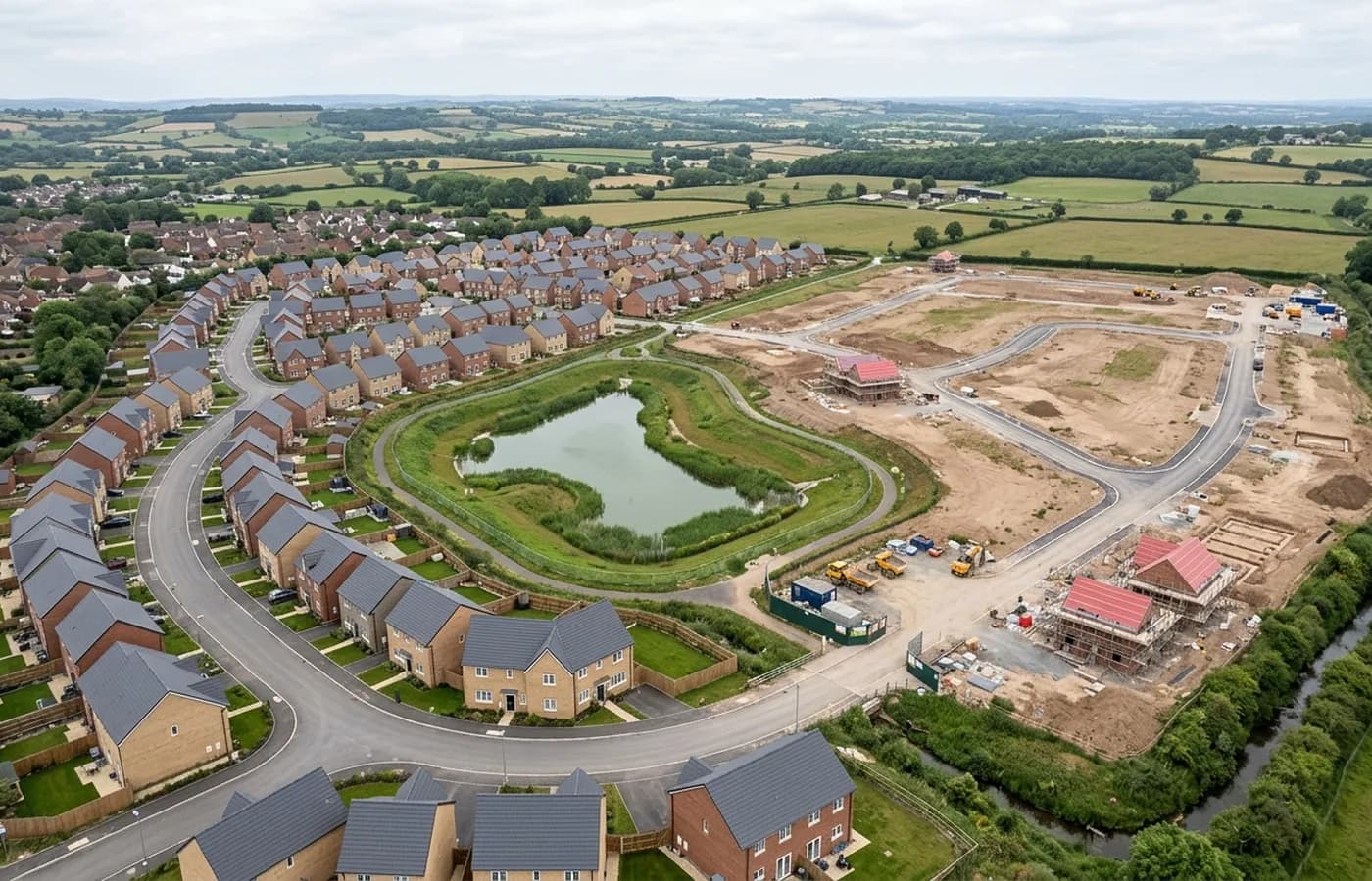
Taunton's expansion has been framed for years as garden communities rather than estates, which in practice means very large allocations on the southern and northern edges of the town, planned as whole neighbourhoods with their own infrastructure.
At that scale a survey is a landscape exercise: several square kilometres of farmland, watercourses, existing lanes, hedge networks and level changes, flown in blocks and assembled. It is the sort of job where deciding what resolution each part actually needs is worth more to the client than flying the whole thing at maximum detail.
A town centre being rebuilt around the river
Alongside the edge growth there is sustained regeneration in the centre, around the station and the river, where brownfield plots come forward with existing structures on them. That is existing conditions work: what stands, at what level, against what boundary.
The mixture means a client working in Taunton often needs both kinds of output from the same programme, and combining them into one visit with two processing runs is usually the cheaper way to get there.
Flat ground that holds water
The Tone valley here is flat and low lying, and the town has a long history with flooding. For mapping, flat ground gives clean, even results, and the terrain model becomes the most valuable output because small height differences decide where water goes.
The same flatness means standing water sits after rain, and sheet water is invisible to the process. A drainage or flood related survey is worth timing to a dry spell, and the note records what conditions were like so nobody misreads a gap in the surface later.
Distance and airspace
Taunton is around fifty minutes from base up the M5, which makes it a comfortable single visit and a natural pairing with Wellington or Bridgwater on the same trip.
Airspace here is more straightforward than in the Yeovil area, but the county is busy with general aviation and military traffic and a check against the actual date is still part of every job rather than an optional extra.
The vale, the hills, and what the air does between them
Taunton sits in a vale ringed by the Quantocks, the Blackdowns and the Brendons, and that ring produces two local effects worth planning around. The low ground holds fog and frost in settled winter weather, sometimes well into the morning, and the surrounding hills produce localised gusting in unsettled weather that does not show in a general forecast for the town.
Neither stops much work, but both argue for a flexible morning rather than a fixed hour. A vale that is fogbound at nine can be clear at eleven, and a survey flown at eleven is a better dataset than one flown into the last of the murk.
The town is also drier overall than most of the Devon towns on this list, so ground conditions on unmade sites recover faster after rain, which matters when a site has to be flown soon after a wet spell.
There is also a steady flow of work around the town's larger single-owner sites, the sports grounds, parks and institutional estates, where a client wants an accurate base plan of ground they already control rather than a survey tied to a planning application.
Behind the survey
What is behind a Taunton mapping flight
CAA registered operator
Operator ID and Flyer ID held, which is the baseline anyone commissioning a flight over a live site should be asking to see before anything takes off.
A2 Certificate of Competency
The qualification that covers flying closer to people and property than the open default allows, which is what a built up site or a town centre survey needs.
100 megapixel Hasselblad camera
On a DJI Mavic 4 Pro. Resolution is the whole argument on a mapping job: it decides whether a stitched site map shows a plot peg or a smudge.
Radiometric thermal camera
A DJI Mavic 2 Enterprise Advanced with a 640 by 512 thermal sensor, for the jobs where a site needs a heat reading alongside the map.
Insured with Coverdrone
Full commercial cover. Certificates go to your site team or your client before the visit if that is part of your process.
Written note within 48 hours
Every job comes with a written record of conditions, coverage and the limits of the data, not just a folder of files with no explanation attached.
Construction background
The surveyor came into this from building work rather than from photography, so a site brief about levels, access and programme lands without translation.
Nearby
Also covered around Taunton
- WellingtonA Blackdown Hills town with a large allocation on its northern side and a station being brought back, so corridor and platform work run side by side.
- BridgwaterSomerset's industrial and logistics town, beside the region's biggest construction project, on drained levels where the terrain model is the whole point.
See the output formats
Request a mapping quote in Taunton
Send the boundary and what the data is for. Sam Hembury will come back with a fixed price for the site and the next slot the weather suits.